Features:
15 km Max Transmission
55-Min Max Flight Time
6 Directional Sensing & Positioning
Primary Flight Display
IP45 Rating
Operate Down to -20 C
Hot-Swappable Battery
UAV Health Management System
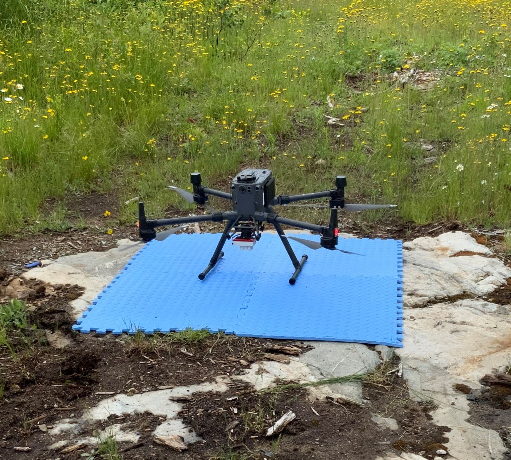
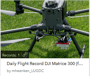
DJI Matrice 300 Remotely Piloted Aircraft System (RPAS)
The Matrice 300 RTK is DJI’s latest commercial drone platform that takes inspiration from modern aviation systems. Offering up to 55 minutes of flight time, advanced AI capabilities, 6 Directional Sensing & Positioning and more, the M300 RTK sets a whole new standard by combining intelligence with high-performance and unrivalled reliability.
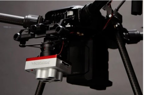
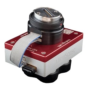
MicaSense RedEdge MX Camera
The RedEdge-MX is a rugged and precise multispectral camera for advanced agricultural analysis. This high-performance tool captures both the spectral bands required for crop health indices (green, red, red edge and near-infrared), a blue band for deeper insights into specific issues, plus composite RGB imagery.
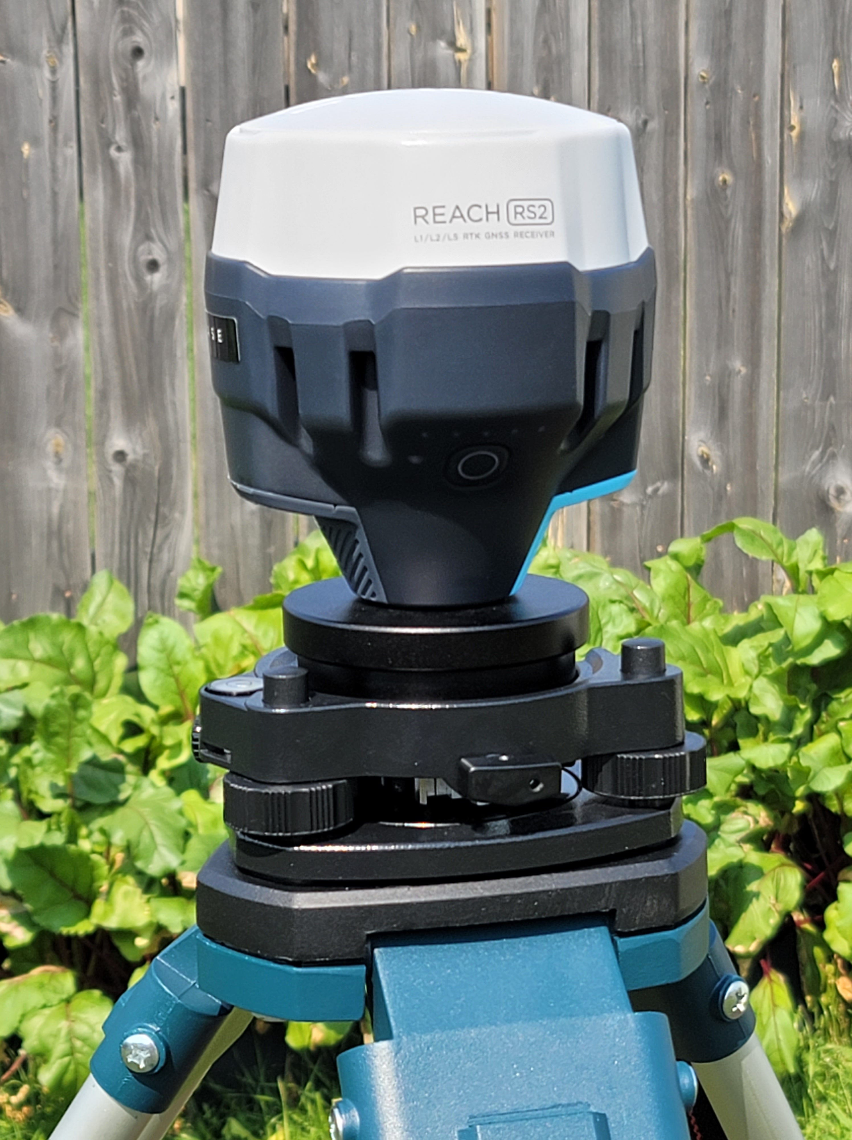
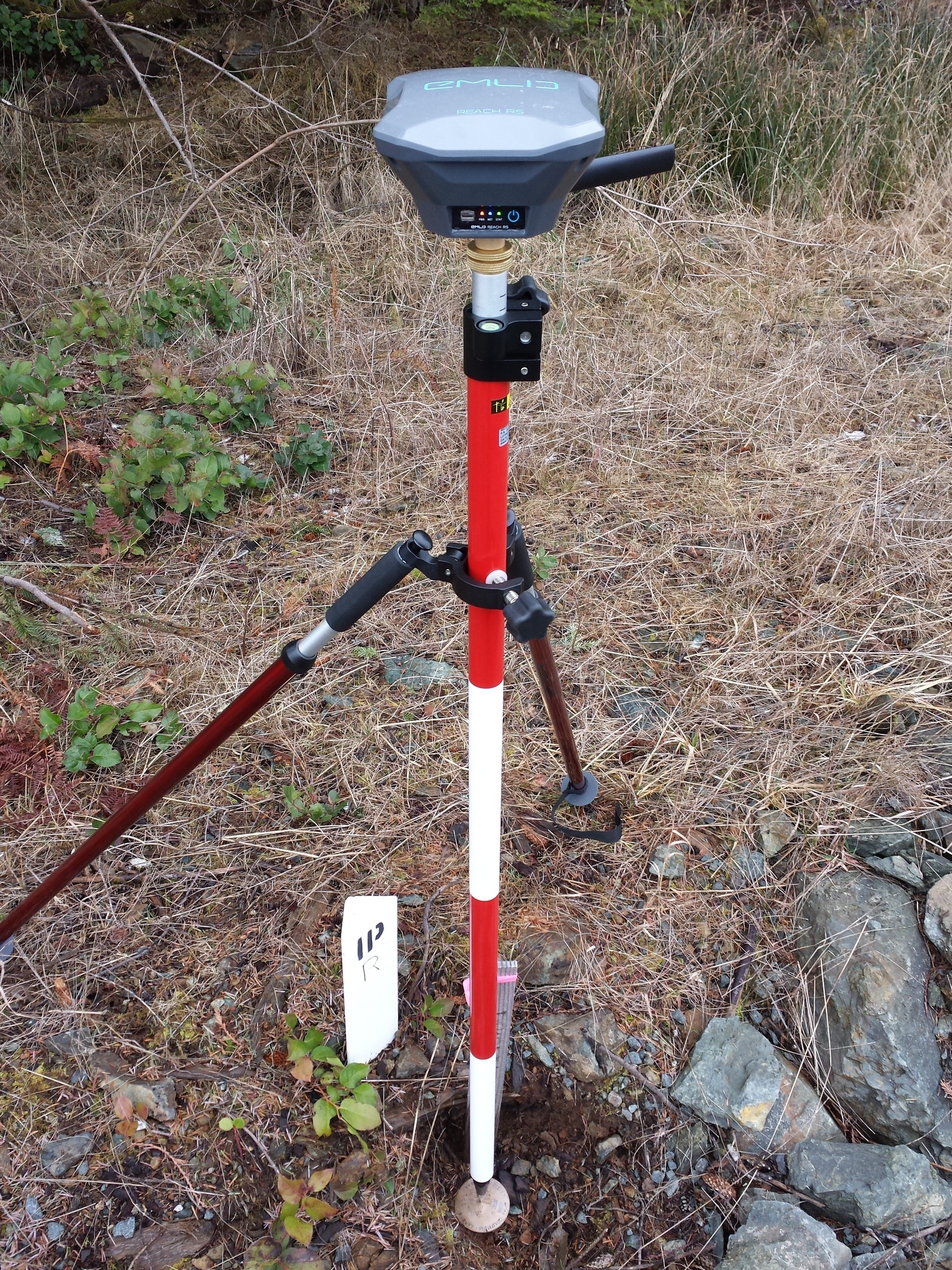
EMLID RS2 Multi-frequency GNSS receiver and RS+ Single frequency GNSS receiver
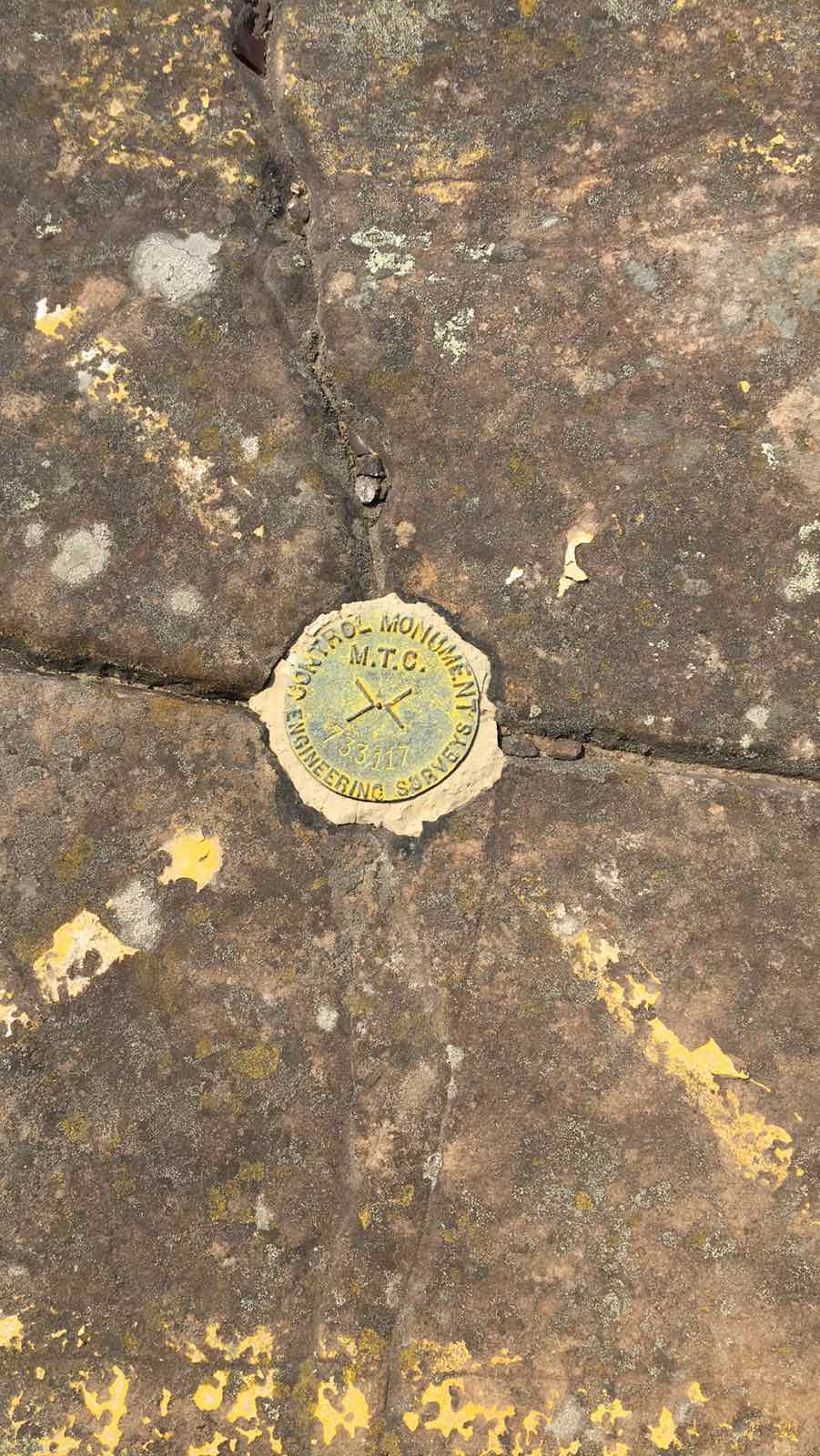
Ground control points (GCPs) are points on the ground with known coordinates. In an aerial surveys, GCPs are used to accurately map large areas. These two receivers are used to measure GCPs by using various advanced techniques.
iPad Pro with LiDAR sensor
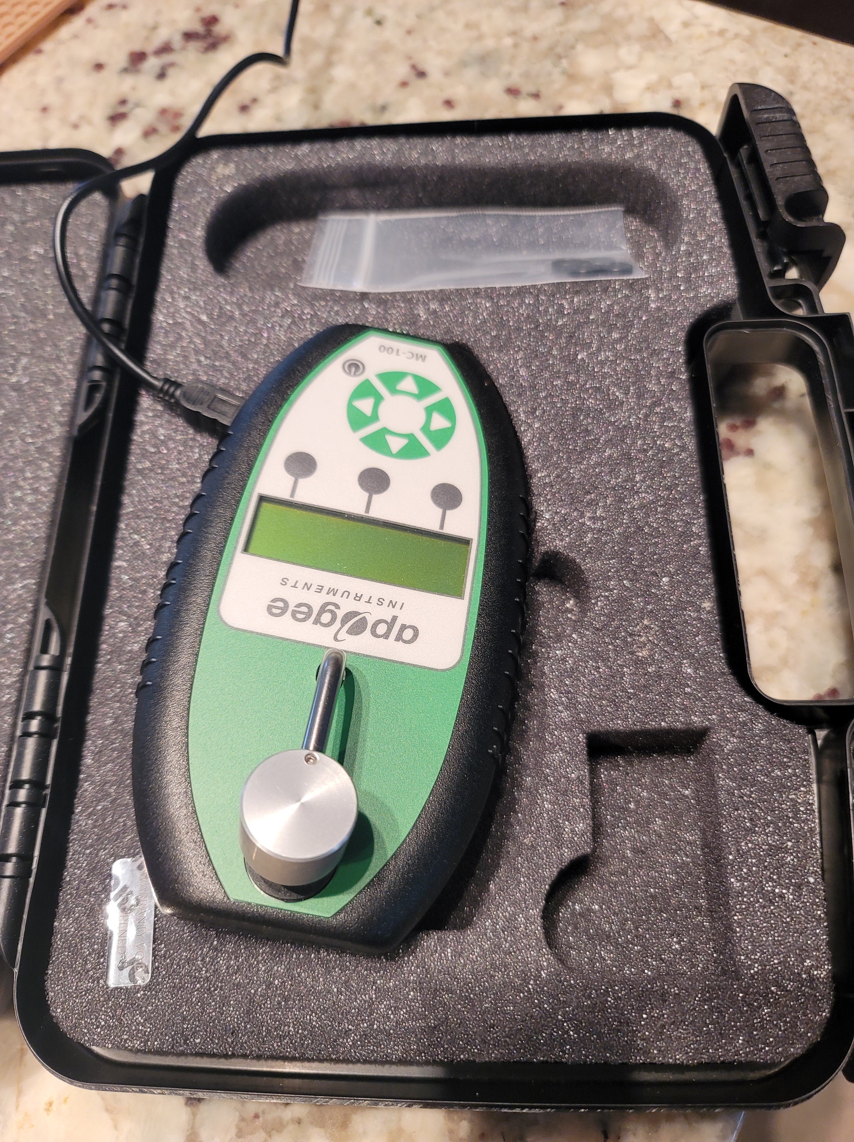
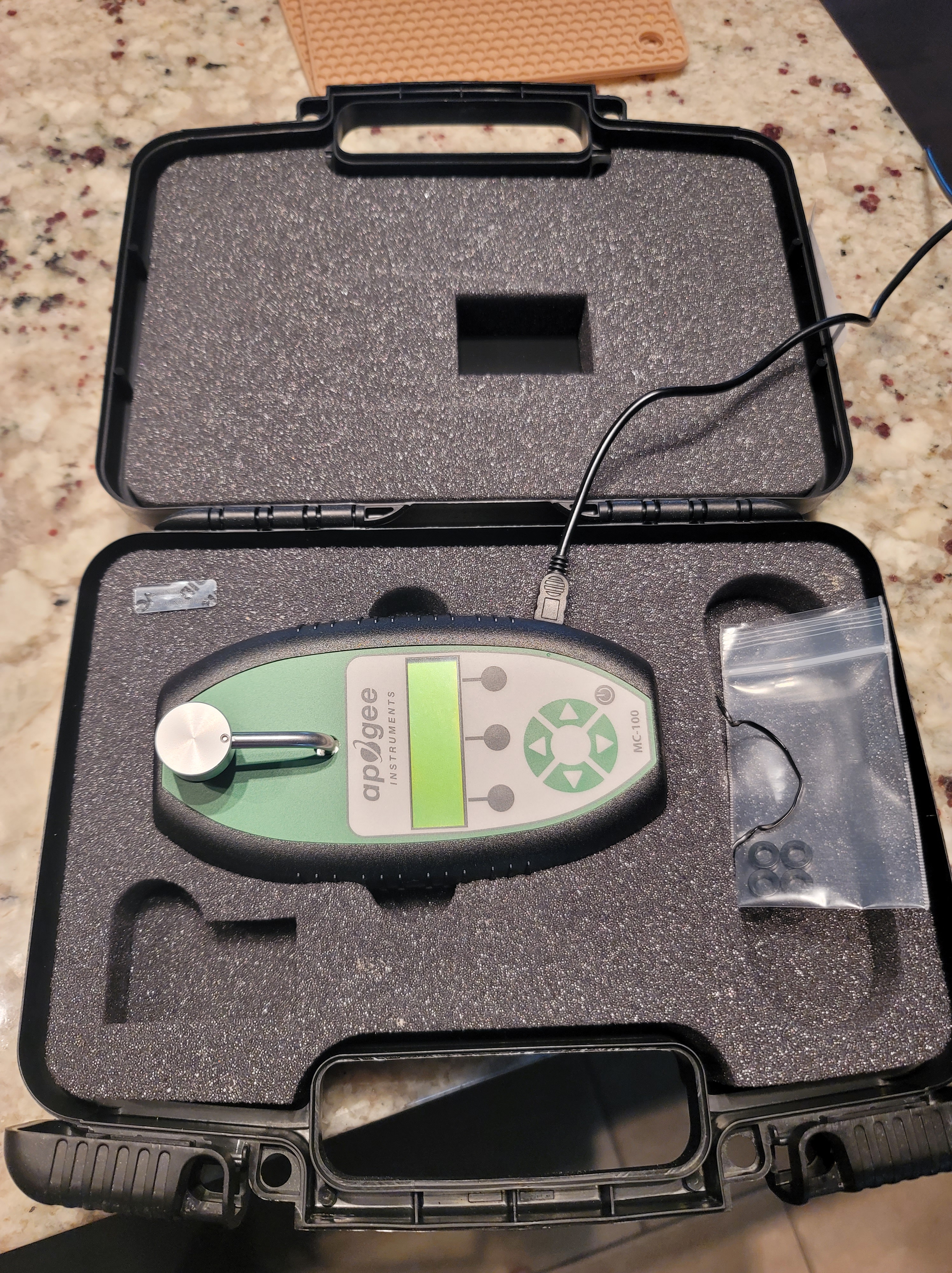
Chlorophyll Meter
The Apogee MC-100 chlorophyll meter directly measures and displays chlorophyll concentration from intact leaf samples without damaging the plant material. The meter is calibrated to measure chlorophyll concentration with units of µmol of chlorophyll per m2. For reference and comparison purposes the meter also outputs relative units (CCI or SPAD). Typical application include chlorophyll concentration determination in leaves for assessment of nutrient status, fertilizer requirements, evaluation of stress, and optimization of harvest.

Software
Pix4D Mapper software for RPAS image processing
Cloud Compare software for LiDAR data processing
Survey 123
We are using this survey as a checklist for preparing the aircraft to fly, pre-flight information and a post-flight safety check. This is accessible to anyone using *.lakeheadu.ca email address.
Other Resources:
