Current Research Projects
Project: Advancing Precision Agronomy for Minimizing the Production Risk
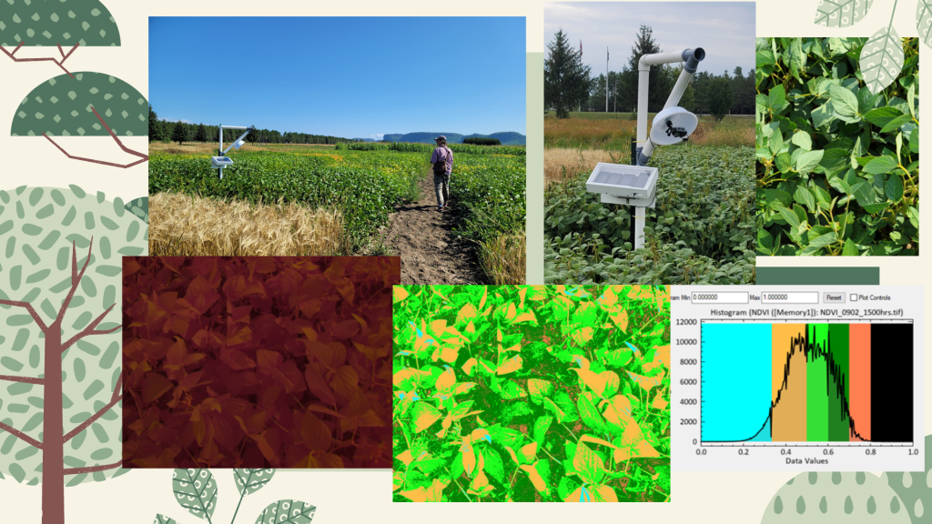
Activities: Northwestern Ontario has a short growing season often challenged by the changing and unpredictable weather—temperature and precipitation. Under this circumstance, increasing productivity, achieving a successful amount of yield and ensuring food security for rural communities is a challenge. There are numerous precision agronomy tools available in the market for balancing field variations and maximizing healthy growth. Although these technologies have increased our ability to understand and monitor field variations, equipment and software are very expensive, technologically advanced, not suitable for urban farmers, and do not represent the local field variations. The main aim of this project is to analyze remotely sensed images over agricultural plots obtained from field cameras to deliver easy-to-understand, robust information to farmers enabling the precision application of fertilizer and other inputs.
The specific research questions are: (a) what properties and orientation of fixed cameras can best capture images of popular crop varieties; (b) what relationships between plant health and nutrients, canopy cover, soil properties, weather, and information derived from these images can be used to inform farmers regarding crop health and site-specific treatments; and (c) How to develop a mobile application and a web browser-based information dashboard to deliver actionable information and advice derived from previous measurements?
Project: Discover big opportunities at your fingertips: Incorporating iPad Pro LiDAR scanner to enhance the quality of forest resources inventories
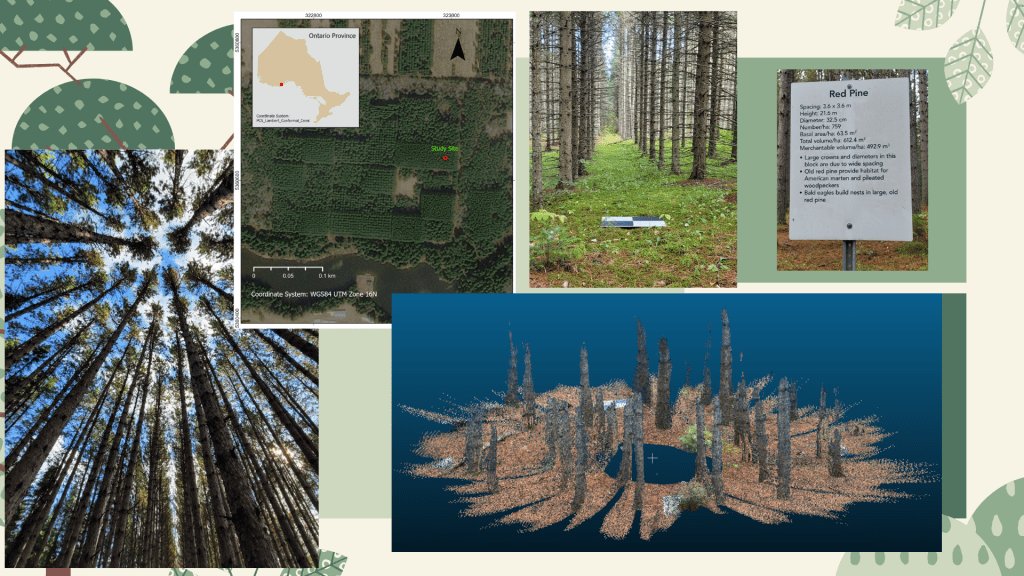
Forest resource inventories normally include information about tree species community composition, range, age, and distribution and ecological and land use conditions. They are primarily based on aerial photograph interpretation and field surveys. Although new technologies like airborne LiDAR and images from RPAS have been incorporated into the inventory process, an extensive field survey campaign is necessary at ground level to collect the data needed to calibrate and validate airborne LiDAR and RPAS data models. Terrestrial LiDAR can be used as a surrogate to reduce the amount of field surveying required and expedite the data collection process. The recently introduced iPad Pro (Apple Inc.) with a LiDAR scanner will be used to collect LiDAR data and develop an automated method to analyze and incorporate information into existing forest resource inventories to enhance accuracy and details. The rapid (nanosecond-scale) scanner can measure reflected light from up to five metres away.
Project: A geostatistical approach to map spatial distributions of baseline information at the Agricultural Research Station, Thunder Bay ON
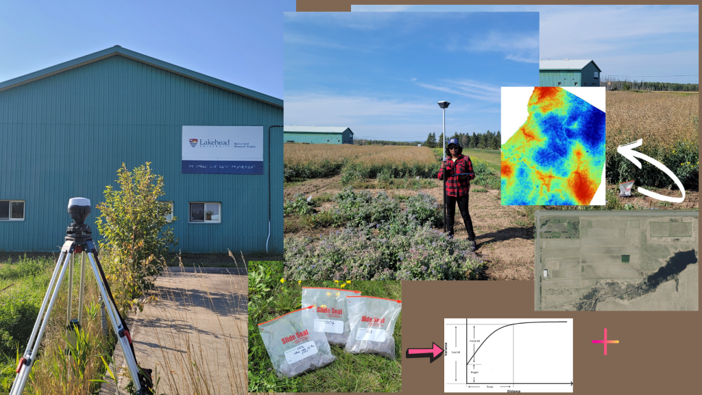
Characterization of spatial variation of soil types, soil nutrients, and groundwater levels are essential in improving the resilience of the crops to climate change impacts. These baseline data should be accurate, up-to-date, and readily available for easy interpretation. The main aim of this is study is to explore different geostatistical methods to create a spatial distribution of soil nutrient levels maps using images acquired from Remotely Piloted Aircraft Systems (RPAS) and field samples. RPAS data will be captured after harvesting before the frost and field samples will be collected at the same time. Vegetation indices that can be derived from remote sensing data and field samples will be used to model the relationship between these two data types. Later, developed relations will be applied to the whole study area to create spatial distribution maps of soil variations. A detailed land use map of the area will also be prepared for future reference. Finally, a cutting-edge web browser-based interface that can be used to visualize these variations will be developed. The final results will be published as a peer-reviewed article to share within a wider community.
Get new content delivered directly to your inbox.
